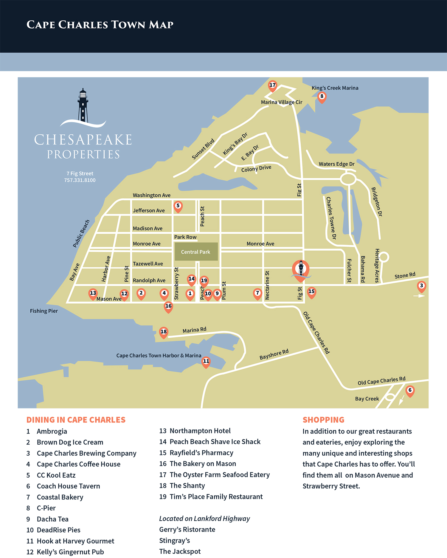
Looking for a Cape Charles map to help you explore this charming bayside town? Whether you’re visiting for the day or staying for a while, this printable town map makes it easy to navigate Cape Charles, VA by foot, bike, golf cart, or car.
Cape Charles is listed on the National Register of Historic Places, and for good reason. Since 1886, the town has welcomed residents and visitors with its timeless beauty and coastal charm. As you explore, you’ll discover rows of historic homes—from elegant Victorian-style houses to classic beach bungalows and unique Sears Roebuck mail-order homes. Cape Charles is also home to an incredible array of restaurants, local boutiques, and family-friendly attractions.
Download or Pick Up a Cape Charles Town Map
You can download our free map of Cape Charles directly from this page, or stop by our office at 7 Fig Street to pick up a printed copy. While you’re there, we’re happy to offer personalized suggestions for things to do, local dining, and can’t-miss attractions.
Use the Cape Charles town map to:
- Find nearby beaches, including the Cape Charles Beach
- Navigate local shops and galleries along Mason Avenue
- Locate golf cart parking areas and charging stations
- Plan walking tours of the historic district
- Discover top restaurants in Cape Charles
- Explore nature spots like the Cape Charles Fishing Pier
Explore More with Chesapeake Properties
We’re proud to help visitors and new residents make the most of their time in Cape Charles. Whether you’re exploring the map or exploring real estate options, stop in and say hello—we’d love to help.


